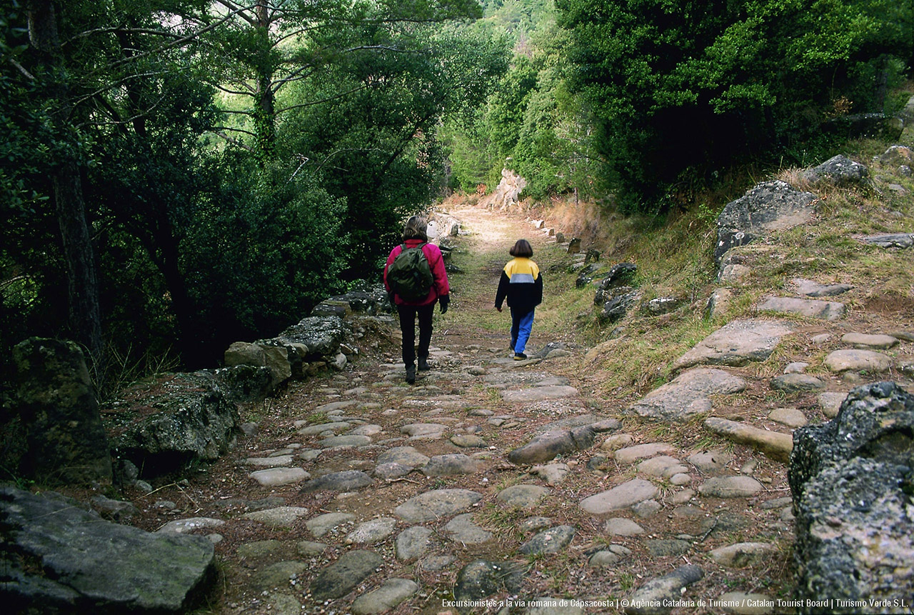
The route of the Roman road has two clearly differentiated parts. On the one hand, we will find some remains in Castellfollit de la Roca, which could have a Roman origin and, on the other, the ancient Roman road from Capsacosta, in Bianya valley, which was built over 2000 years ago. We will start the tour in Castellfollit de la Roca, in the vegetable gardens of Turonell, located between the creek which takes the same name and the basaltic scarp. Supposedly, the Roman road came from Besalú, following Fluvià, and went up to the cliff, along the Rossolada path, where nowadays the village of Castellfollit de la Roca is found. It is believed that this cobbled path follows the ancient Roman road. Once at the top, it turned right until the present square of Josep Pla, from where still today some spectacular views of the area can be admired. From behind the old church, now turned into an exhibition hall and with a privileged view of the bell tower, it is believed that the first Roman road continued to the present street Vell, street Del Fortí and street Nou, until getting to Sant Roc square, where there is the clock tower, with a very peculiar history. From here it would have followed in direction to Sant Joan les Fonts. However, the remains cannot confirm that this branch of the Roman road was present at this point in time, before continuing to Capsacosta hill. This route would follow Fluvià valley and would turn Castellfollit de la Roca scarps into a watchtower. It is known that these kind of geographical features were highly appreciated by the Romans. There are not any other Roman remains until Bianya valley, where it starts what we call the Roman road. From Castellfollit de la Roca we can get there by car or on foot, following some of the signposted routes. We can start the walk from Sant Salvador de Bianya or from Traginers path. If we do it from the village of Sant Salvador de Bianya, we will go deep into a path surrounded by forests, which will take us to Sant Pau de Segúries, going up Capsacosta hill, along 6,2 km and a slope of 420 meters. In the steepest parts, slopes exceed 10%. Along this excursion, we will find some very well preserved parts and others which have deteriorated over time. It is important, though, not to wear Roman sandals, since we will walk on thousand-year old stones. This part, the only one preserved, was part of a route which was separated from the great Via Augusta, connecting Roma with Cadis. This branch allowed people to go deep into the Pyrenees and it is believed it crossed them by Ares hill. It must be taken into account that, apart from people and animals, carriages were also commonly seen. As you will see, it now seems impossible to imagine vehicles with wheels travelling through these paths. Some great evidence of the popularity this route had ages ago are the remains of hostels from the 17th century. As time went by and with the improvements in the roads, it became disused and, later it was turned into a stock road. The Roman road is nowadays properly signposted. It is marked with a lot of signs indicating the main road or secondary ones. As we go up the road we will see some parts more similar to how they used to be 2000 years ago. There are very well preserved parts and others which have deteriorated over time. It must be noted how its tight turns near Capsacota, the pavements, drains and many other details were used to gain altitude. You do not have to stare at the ground on which others have walked in the past to enjoy this walk, though. In the parts where the abundance of vegetation allows it, we will understand why the village is called Vall de Bianya. Hills and mountains ranges rise up, leaving humid valleys in between them. We will be able to contemplate them from a privileged viewpoint, for its location and history. We can also note the difference in the vegetation on one side and the other. On the river Fluvià side, holm oaks and oaks predominate, and on the river Ter side, even more humid and high, beech and pastures.
